Second Temple
The Second Temple period (516 BCE to 70 CE) covers Jewish life from the return from Babylonian exile to the Roman destruction of the Temple. Posts here cover Herod’s fortresses at Masada and Herodion, Second Temple Jerusalem, and the archaeology of Jewish life across the country including the Hasmonean and Herodian dynasties.
8 articles
8 articles
Masada
A return visit to Masada, the desert fortress and UNESCO site above the Dead Sea: the cistern network, the Roman ramp, the Byzantine church mosaic, the Western Palace, the Northern Palace and one of the world’s oldest synagogues.


Herodion


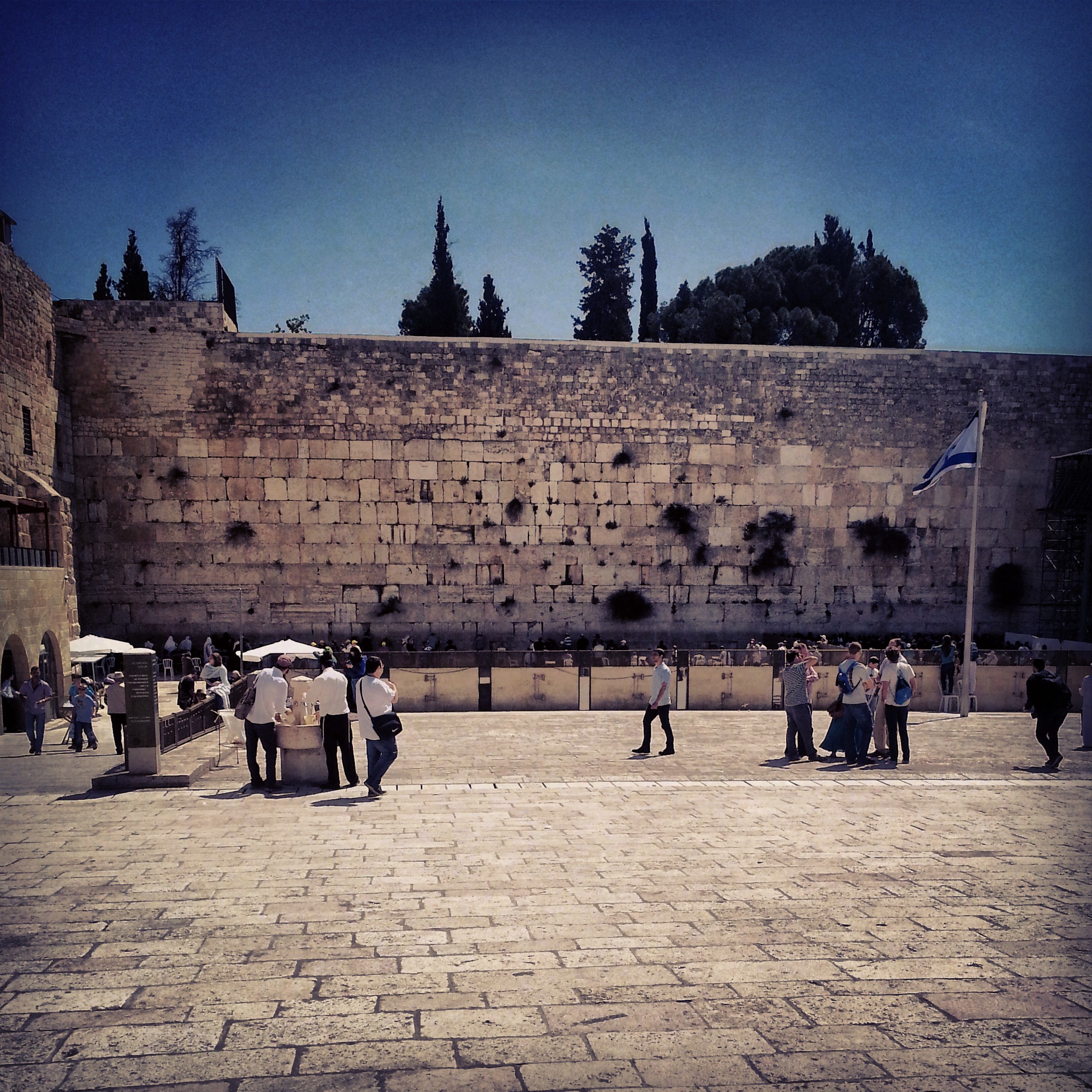
Jerusalem in the Second Temple period
A field trip through Jerusalem's Second Temple period sites: the City of David, the Tyropoeon valley drainage channel, the Davidson Centre, the Burnt House, the Wohl Museum of Archaeology, and the excavations beneath the Western and southern walls of the Temple Mount.


Jerusalem: First Temple and Second Temple Periods
A field-trip filling in the gaps between the two Jerusalem temple-period days: the Roman 10th Legion's camp under Binyanei Hauma, the Western Wall Tunnels, an advance preview of the Eastern Cardo, the Kidron mausolea and the burial tombs at Ketef Hinnom.


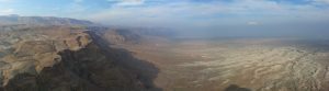
Archaeology of the Biblical Negev
A field-trip day through the biblical Negev — the Joe Alon Centre for Bedouin culture, then south to the UNESCO-listed Tel Beer Sheva and the early-Canaanite ruins of Tel Arad.


The Ancient Sea Road (Via Maris)
A storm-soaked field trip along the ancient Sea Road: El Ahwat, the Katzir viewpoint, Tel Megiddo and Tel Jezreel, the Beit Alfa synagogue mosaic, and a hail-pelted finale on the Gilboa ridge.


The Lower Galil
A first overview of the Lower Galil: the ancient mound of Tel Chanaton, the Muslim Arab villages of Kaukab Abu al-Hija and Deir Hanna, the ruined city of Yodfat, the meditative village of Hararit and the communal settlement of Avtaliyon.


Northern Judean Desert
First trip of the guiding course took us down into the northern Judean Desert, from the Inn of the Good Samaritan and the Wadi Kelt viewpoint to Einot Tzukim, Qumran and Nabi Musa. Twelve hours, eight sites, plenty of Hebrew vocabulary added to the lexicon.


If you are going to Israel, you would be mad not to give him a call.
Amol Rajan, BBC presenter and broadcaster
Having been on trips in Israel with seven different tour guides, Samuel stood above all the rest.
Seasoned Israel traveller
Samuel is one part walking encyclopedia, one part storyteller, one part stand-up comedian.
Berkeley Haas Business School student