North
Northern Israel covers the Galilee hills, the Hula bird-migration corridor, Mount Carmel, the Golan Heights, and the slopes of Mount Hermon. The posts here include hiking days (the Zavitan Stream, Nachal Amud) alongside the region’s settlement history and older sites: Crusader fortresses, Roman ruins, biblical narrative places.
29 articles
29 articles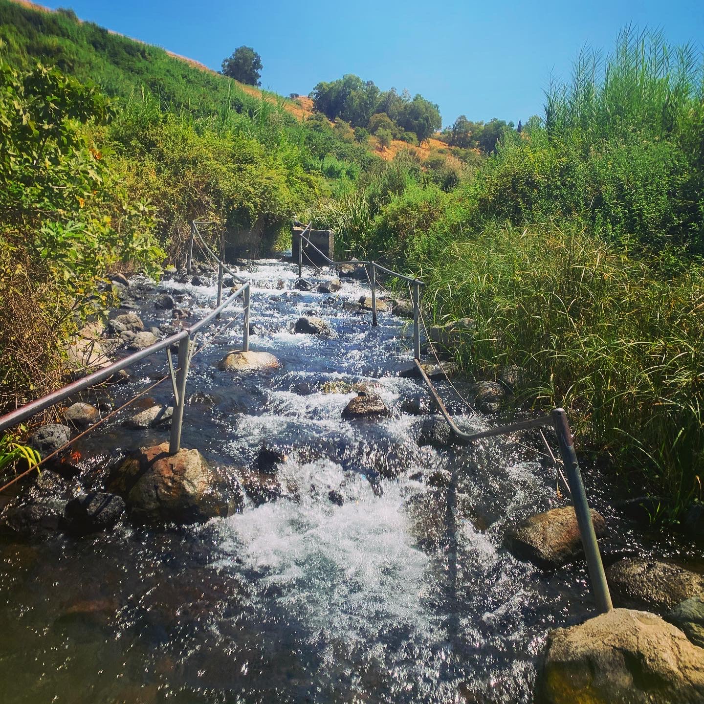
Going off the beaten path in northern Israel
A two-day road trip through the Galilee Panhandle and the Golan Heights: the Hunin Crusader fortress, a sealed Hezbollah tunnel near the Lebanon border, the Roman temples at Hurvat Omrit, the Hexagon Pool, and a Yom Kippur War memorial at Tel Saki.


Cooling off in the Valley of Springs
A day relaxing in the springs of the Beit She'an Valley in northern Israel: the Park of Springs, the Harod Spring at Maayan Harod National Park, and a pelican migration in the fish pools.


Hiking to the top of Israel: Mt Hermon
Hiking the 2,040m peak of Mt Hermon on Israel's northern border in the middle of summer: the heat, the army permission, the views from above the clouds, and the berry picking on the way home.


Nachal Amud and Migration in the Hula
A perfect autumn hike down through Nachal Meiron and Nachal Amud, followed by a drive across the Galilee to the ancient synagogue at Bar'am and the migrating cranes at the Agamon.


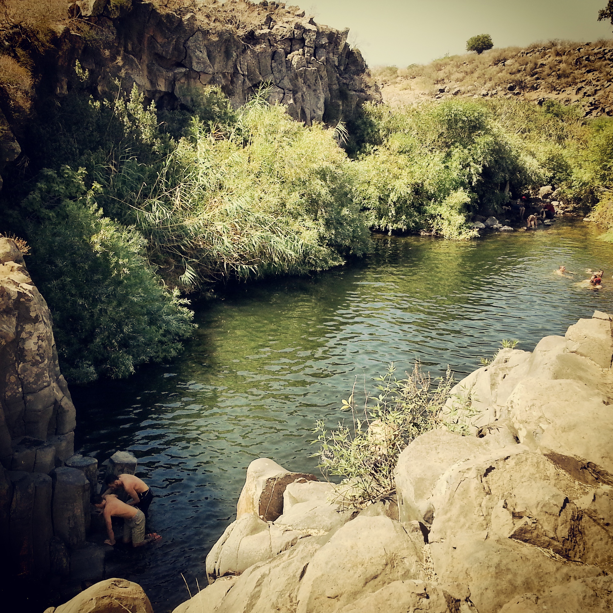
Hiking the Zavitan Stream
A short hike on the upper Zavitan stream in the Yehudiya Nature Reserve, with basalt-column pools, a waterfall and plenty of opportunity to cool off in the Golan heat.


Flying falafel at Mifgash Golani
Mifgash Golani in Afula is famous for its falafel, but really for the falafel acrobatics performed by the staff. Quite remarkable, and well worth a stop on the way north.

Settlement of the Jordan Valley
A day through the Jordan Valley and the southern Sea of Galilee: the Harod Spring, the Roman bridge and hydroelectric ruins at Old Gesher and Naharayim, the Kinneret Courtyard and Rachel the Poet, Degania, the Motor House and the Kinneret Cemetery.


Safed / Tzefat
A return to Tzefat, where I spent three months on my gap year, this time as a guiding student. Akhbara, Mt Canaan, the kabbalists' synagogues of the Old City and a sunset over the Crusader citadel.


Settlement of the Jezreel Valley
A field trip across the Jezreel Valley tracing the early-Zionist settlement of the area: Tel Yoqneam, the Valley Railway museum, the Templer villages of Bethlehem of Galilee and Waldheim, the Nahalal cemetery, Merhavia and Sejera.


Eastern Lower Galilee
A field trip around the eastern lower Galilee, the basalt-cliff region between the Sea of Galilee and the central Galilee: Mount Arbel and its ancient synagogue, the Druze shrine of Nabi Shu'aib, ancient Korazim, Domus Galilaeae and Tel Mutilla.


If you are going to Israel, you would be mad not to give him a call.
Amol Rajan, BBC presenter and broadcaster
Having been on trips in Israel with seven different tour guides, Samuel stood above all the rest.
Seasoned Israel traveller
Samuel is one part walking encyclopedia, one part storyteller, one part stand-up comedian.
Berkeley Haas Business School student