Sharon
The Sharon Plain runs up Israel’s central Mediterranean coast, from north of Tel Aviv to the Carmel ridge. The posts here cover Roman and Crusader Caesarea, the late-Bronze-Age Sea Peoples sites along the coast, and the 19th-century Zionist towns like Zichron Yaakov.
4 articles
4 articles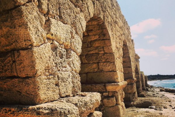
Caesarea
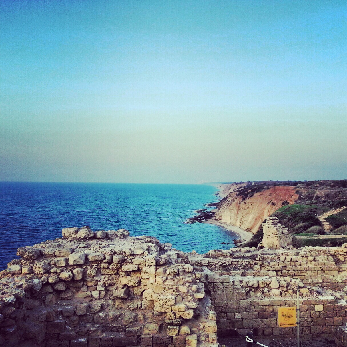
A day around Caesarea: the Byzantine flour mills at Nachal Taninim, the Hadrianic aqueducts at Beit Hanania, the national park itself with Herod's port, hippodrome, theatre and bathhouse, and the birds mosaic to the north.


The Sea Peoples
Following the footsteps of the Sea Peoples along the southern coast: Tel Qasile in the Land of Israel Museum, Izbet Sartah, the Crusader fortress of Migdal Tzedek, Tel Afek / Antipatris, ancient Ashkelon and Jonah's Hill above the Ashdod port.


Zichron Yaakov and surroundings
A field trip from Zichron Yaakov and the First Aliyah pioneers to Baron de Rothschild's mausoleum at Ramat Hanadiv, the Etzel and Roman ruins at Shuni, the Mei Kedem aqueduct and the Atlit detention camp.


The Sharon Plain
A day on the Sharon coastal plain, off the regular tourist trail: viewpoints at Tzur Natan, an Ottoman tomb on a Samaritan synagogue, the Crusader ruins of Kakun, a soft-shelled turtle hike along Nachal Alexander, the Cheftzi-ba farm, and the cliff-top archaeology of Apollonia.


If you are going to Israel, you would be mad not to give him a call.
Amol Rajan, BBC presenter and broadcaster
Having been on trips in Israel with seven different tour guides, Samuel stood above all the rest.
Seasoned Israel traveller
Samuel is one part walking encyclopedia, one part storyteller, one part stand-up comedian.
Berkeley Haas Business School student