Samaritans
The Samaritans are an ancient Israelite community of a few hundred people centred on Mount Gerizim above Nablus/Shechem. Posts here cover the Samaritan heartland in Benjamin and Samaria, the Samaritan-era synagogue remains on the Sharon Plain, and the Samaritan presence in the wider Northern Judean Desert story.
3 articles
3 articles
Benjamin and Samaria
A field trip into the West Bank: the archaeological site at Shiloh (briefly home to the tabernacle), a fog-bound viewpoint from Mt Kabir, and Mt Gerizim — holy site of the Samaritans.


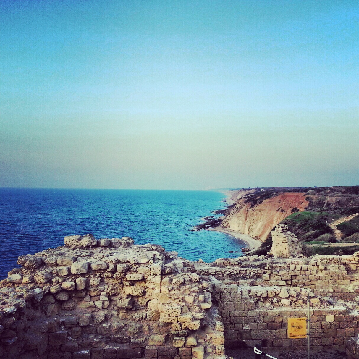
The Sharon Plain
A day on the Sharon coastal plain, off the regular tourist trail: viewpoints at Tzur Natan, an Ottoman tomb on a Samaritan synagogue, the Crusader ruins of Kakun, a soft-shelled turtle hike along Nachal Alexander, the Cheftzi-ba farm, and the cliff-top archaeology of Apollonia.


Northern Judean Desert
First trip of the guiding course took us down into the northern Judean Desert, from the Inn of the Good Samaritan and the Wadi Kelt viewpoint to Einot Tzukim, Qumran and Nabi Musa. Twelve hours, eight sites, plenty of Hebrew vocabulary added to the lexicon.


If you are going to Israel, you would be mad not to give him a call.
Amol Rajan, BBC presenter and broadcaster
Having been on trips in Israel with seven different tour guides, Samuel stood above all the rest.
Seasoned Israel traveller
Samuel is one part walking encyclopedia, one part storyteller, one part stand-up comedian.
Berkeley Haas Business School student