Christianity
Israel’s Christian heritage spans New Testament Galilee, Byzantine monasteries, Crusader Jerusalem, and the late-Ottoman churches of the Old City. Posts here cover Bethlehem and the Church of the Nativity, Roman-Byzantine Jerusalem, the Carmelite monastery at Stella Maris, the Holy Sepulchre, and the Christian quarters of the Old City.
19 articles
19 articles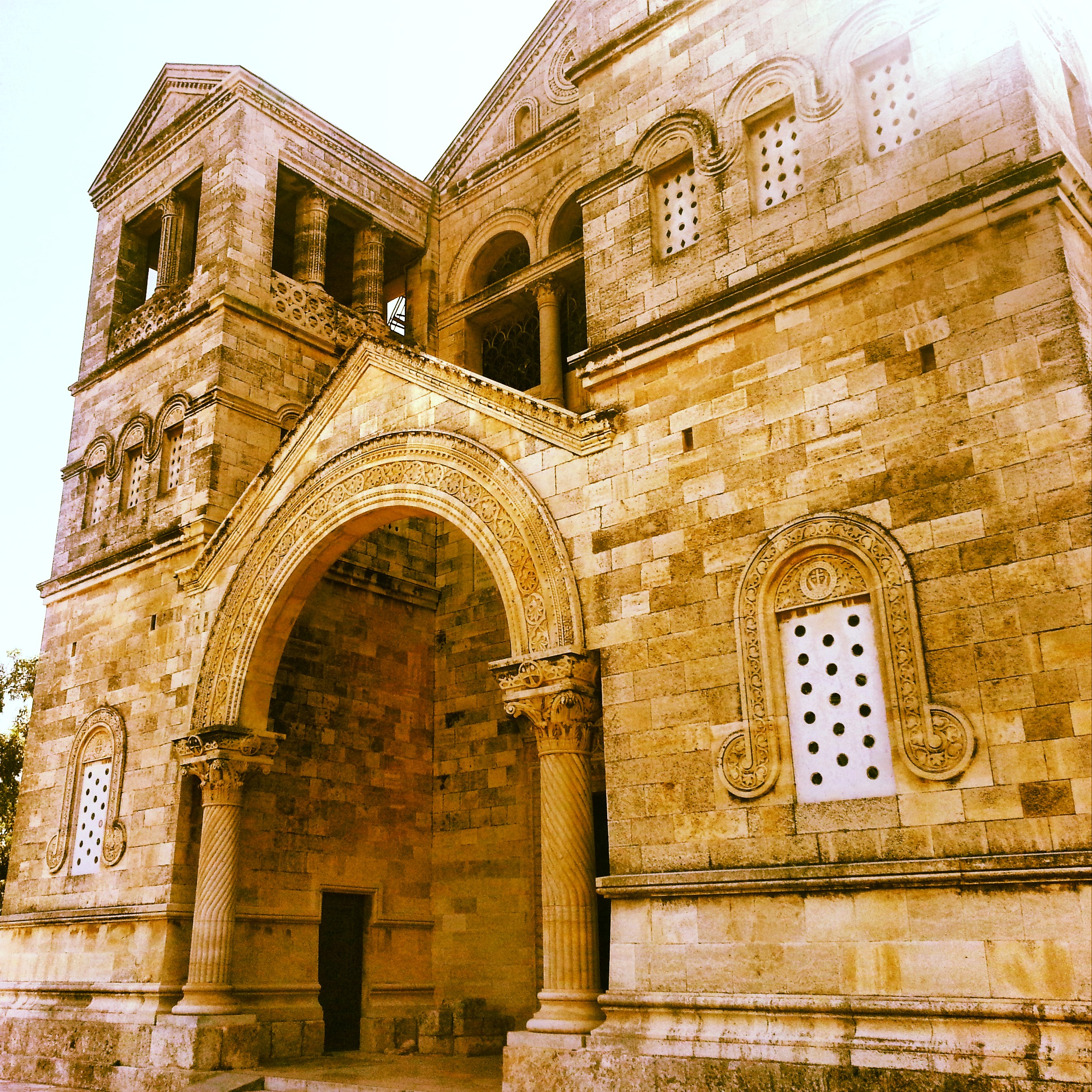
Christianity in the Galilee
My first Christianity-focused field trip in the Galilee: the Church of the Transfiguration on Mt Tabor, the wedding-miracle churches at Kfar Kana, four churches in Nazareth, and the views from Mount Precipice.


Benjamin and Samaria
A field trip into the West Bank: the archaeological site at Shiloh (briefly home to the tabernacle), a fog-bound viewpoint from Mt Kabir, and Mt Gerizim — holy site of the Samaritans.


Nabatean Cities in the Negev
A field-trip to two of the Nabatean cities of the Negev, Mamshit and Avdat, now a UNESCO world heritage site: the ingenious cisterns, the spice and wine trade, the assimilation into Roman and then Byzantine Christian culture.


South Mount Hebron
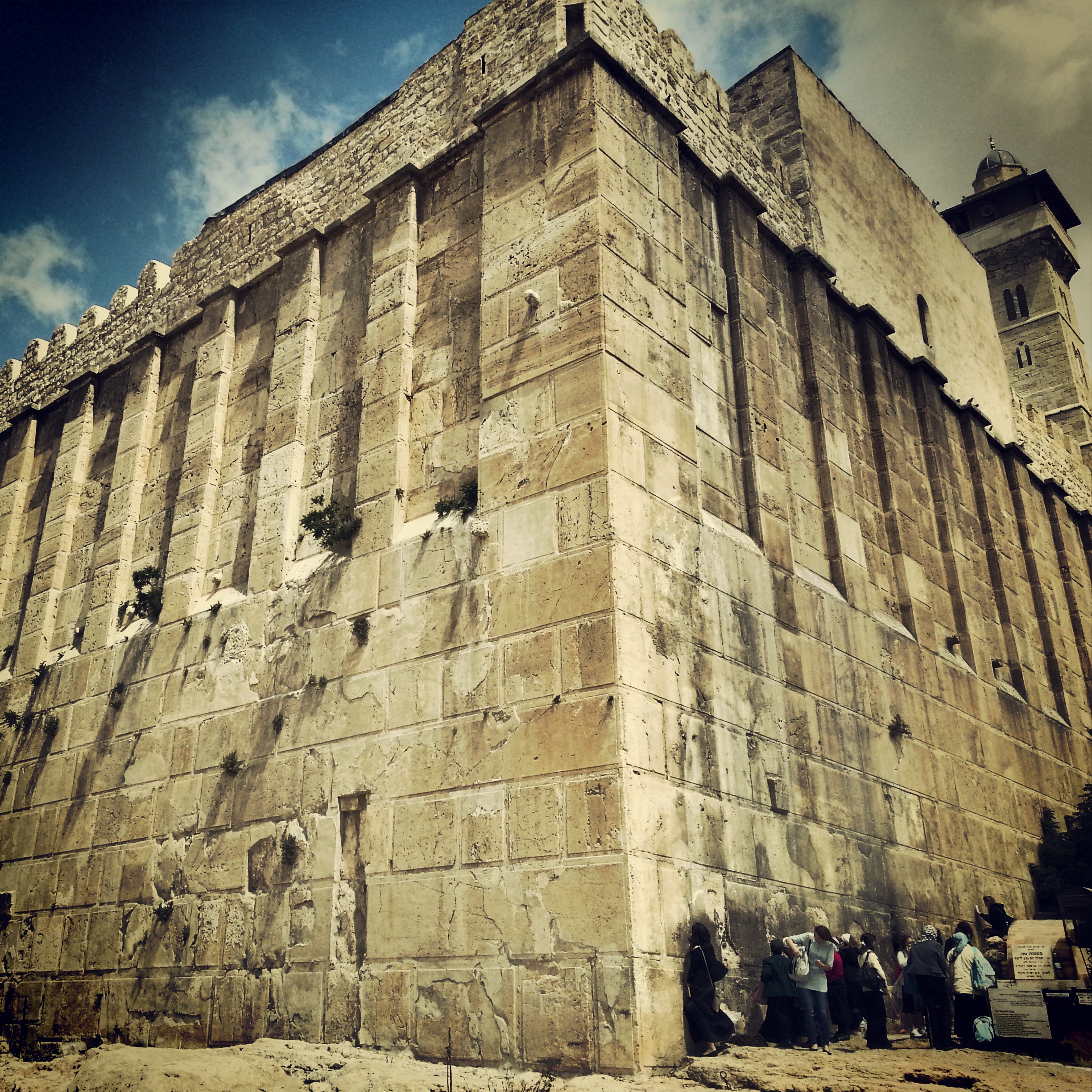
Returning from glandular fever for a complex field-trip to the South Hebron Hills: the Cave of Machpela, Tel Rumeida, the Byzantine ruins of Susya and Anim, and the illegal outpost at Avigail. Politics unavoidable, the day deeply absorbing.


The Ancient Sea Road (Via Maris)
A storm-soaked field trip along the ancient Sea Road: El Ahwat, the Katzir viewpoint, Tel Megiddo and Tel Jezreel, the Beit Alfa synagogue mosaic, and a hail-pelted finale on the Gilboa ridge.


The Jordan Valley
A field trip down the Jordan Valley: the Byzantine monasteries of Martyrius, St Euthymius and St Gerassimos; the baptism site at Qasr el Yahud; the Jordan Valley Monument; and an evening sing-song at the Mabua spring.


The Lower Galil
A first overview of the Lower Galil: the ancient mound of Tel Chanaton, the Muslim Arab villages of Kaukab Abu al-Hija and Deir Hanna, the ruined city of Yodfat, the meditative village of Hararit and the communal settlement of Avtaliyon.


Mount Carmel
A day on Mount Carmel, from the panoramic Mishmar HaCarmel viewpoint and the burn scars of the 2010 fire to Little Switzerland, the Chai Bar wildlife reserve, the Druze town of Daliyat-al-Carmel and the Muchraka monastery linked to the prophet Elijah.


Northern Judean Desert
First trip of the guiding course took us down into the northern Judean Desert, from the Inn of the Good Samaritan and the Wadi Kelt viewpoint to Einot Tzukim, Qumran and Nabi Musa. Twelve hours, eight sites, plenty of Hebrew vocabulary added to the lexicon.


If you are going to Israel, you would be mad not to give him a call.
Amol Rajan, BBC presenter and broadcaster
Having been on trips in Israel with seven different tour guides, Samuel stood above all the rest.
Seasoned Israel traveller
Samuel is one part walking encyclopedia, one part storyteller, one part stand-up comedian.
Berkeley Haas Business School student