Wildlife
Israel sits on one of the world’s busiest bird-migration corridors, with half a billion birds passing through the Hula Valley each year. Posts here cover the Hula’s autumn and spring migrations, desert wildlife in the southern Arava, the Sharon plain’s coastal habitats, and the natural-history collections at Tel Aviv’s museums.
6 articles
6 articles
Nachal Amud and Migration in the Hula
A perfect autumn hike down through Nachal Meiron and Nachal Amud, followed by a drive across the Galilee to the ancient synagogue at Bar'am and the migrating cranes at the Agamon.


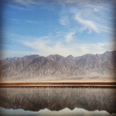
Campus Eilat Day Three: Southern Arava
Day three of Campus Eilat: heading up the Southern Arava — the Eilat Bird Park, the Avrona farms and fugarot tunnels, the Doum Palms, Shechoret Canyon, the Chai Bar and a desert kite, ending with a Chanukah candle lighting back in Eilat.


Tel Aviv Museums
A field-trip day around Tel Aviv University — the Zoological Gardens, the Botanical Gardens, the Palmach Museum and the Diaspora Museum, with a chameleon cameo and a touching memorial.


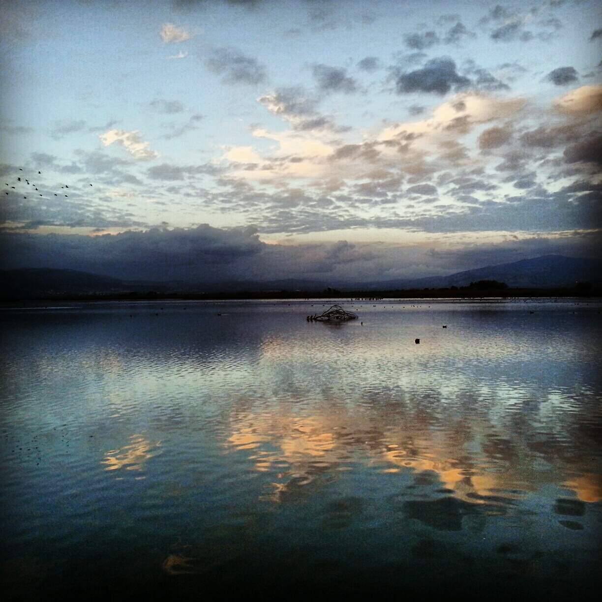
Hula Valley
A day in the Hula Valley: Rosh Pina's restored First Aliyah old town, the Mitzpe Nimrod lookout, the Crusader Castle of Chastellet, the Mishmar Hayarden memorial and the Hula and Agamon reserves at dusk when half a billion migrating birds land.


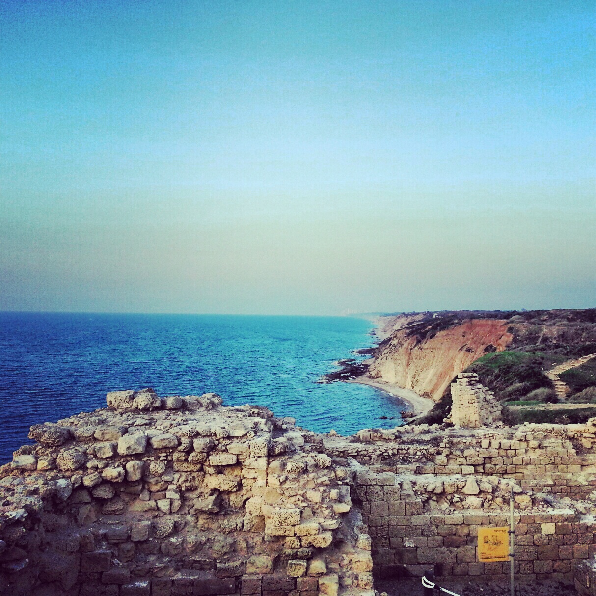
The Sharon Plain
A day on the Sharon coastal plain, off the regular tourist trail: viewpoints at Tzur Natan, an Ottoman tomb on a Samaritan synagogue, the Crusader ruins of Kakun, a soft-shelled turtle hike along Nachal Alexander, the Cheftzi-ba farm, and the cliff-top archaeology of Apollonia.


Mount Carmel
A day on Mount Carmel, from the panoramic Mishmar HaCarmel viewpoint and the burn scars of the 2010 fire to Little Switzerland, the Chai Bar wildlife reserve, the Druze town of Daliyat-al-Carmel and the Muchraka monastery linked to the prophet Elijah.


If you are going to Israel, you would be mad not to give him a call.
Amol Rajan, BBC presenter and broadcaster
Having been on trips in Israel with seven different tour guides, Samuel stood above all the rest.
Seasoned Israel traveller
Samuel is one part walking encyclopedia, one part storyteller, one part stand-up comedian.
Berkeley Haas Business School student