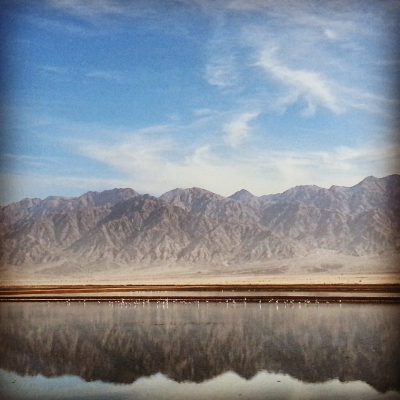
Category: South

Campus Eilat Day Four: Timna

Read about our first day of the Eilat Campus (exploring the Northern Arava and the Ovda Valley), our second day (exploring the area of Eilat and the Eilat Mountains) or our third day (exploring the Southern Arava).

With mixed feelings, we arrived at the last day of the campus. On the one hand, the tour had been very enjoyable, very interesting and the breakfast and dinner buffets were rather marvellous. On the other, we were exhausted! They push you hard on the tour guide course!

Still, there was one final trip before heading back north, a visit to Timna, also known as King Solomon’s Mines. I was excited to visit the park, a major site in Israel which to my recollection I had never been to previously (my mother later told me that I had been there as a very young child), and I am pleased to say that it did not disappoint.

We began our visit with a short film about the site (it was cute, although it was badly tinted green due to a projector problem – I thought perhaps related to copper oxidisation – ho ho!) and then proceeded into the park, a large valley formed by ancient geological turbulence in the area.

Arch at Timna
Arch at Timna

We began our visit at the site of the Arches. Although not as impressive as my visit to the Arches National Park in Utah a few years ago, the effects of the weathering on the local sandstone were still rather beautiful. We went on a short walk through the largest arch and descending to a former copper mine. Everywhere we went it was possible to see specks of green in the rock; signs of the wealth of copper in the area. We had a good crawl through the ancient mine (dating up to 7000 years ago!).

Crawling through an ancient copper mine in Timna

From here, we visited the site known as the mushroom, another geological weathering formation. At the lookout were replicas of the tools used in ancient copper manufacture, and our guide explained the process to us from start to finish. It really is impressive that these ancient men managed to work out the complicated chemical process to extract the copper from the ore. No doubt a huge amount of trial and error was involved as they refined the process over time, eventually stumbling on the idea to combine the copper with tin, forming bronze, and ushering in the Bronze Age.

Copper ore in Timna sandstone

We learned that the peak of Timna’s copper production was under Egyptian stewardship in the 14th-12th centuries BCE, although they did so in partnership with locals. Copper was very important for the Egyptian pharaohs both for personal and ritual use.

Ancient hunting scene etched in the rock at Timna

On the Egyptian theme, we travelled a short distance to see an ancient wall inscription of a hunting scene from the 12th century BCE. It is unclear whether it was done by a bored worker or was commissioned as a piece of art, but it was quite remarkable to see these etchings still on the rocks thousands of years later.

Ancient temple / ritual site in Timna

A short drive then took us to an ancient ritual area, used jointly by the Egyptians and the local workers of the mines, with both kinds of gods and rituals present. It is unclear who these locals were although the leading theory suggests that these were the Midianites, a tribe that the bible tells us used to live in the area. In this temple was found a copper snake, similar perhaps to the one famously used by Moses. It is now in the Eretz Yisrael Museum in Tel Aviv.

View over King Solomon's Pillars, Timna
View over King Solomon’s Pillars, Timna

Leaving the temple, we ascended into the cliff face, noting the large seal of the Pharaoh Ramses III hewn into the rock, before descending to the area known as King Solomon’s Pillars. Here, our guide explained to us the link with King Solomon and Timna which developed in the 19th century. There was evidence found there of mining in the 10th century BCE, which is believed to be the time of King Solomon. As we know there was a great deal of copper in the temple, perhaps this was his main mine.

This theory was dashed when it was discovered that the real peak of the mining here was in the Egyptian period, but discoveries last summer reopened the question. I shall look forward to sharing the full details with tourists in the future!

On that mysterious note, it was time to begin the long journey back to Tel Aviv. Next week we return to the normal routine (and weather). Of course, I shall continue to keep you posted!

Campus Eilat Day Three: Southern Arava
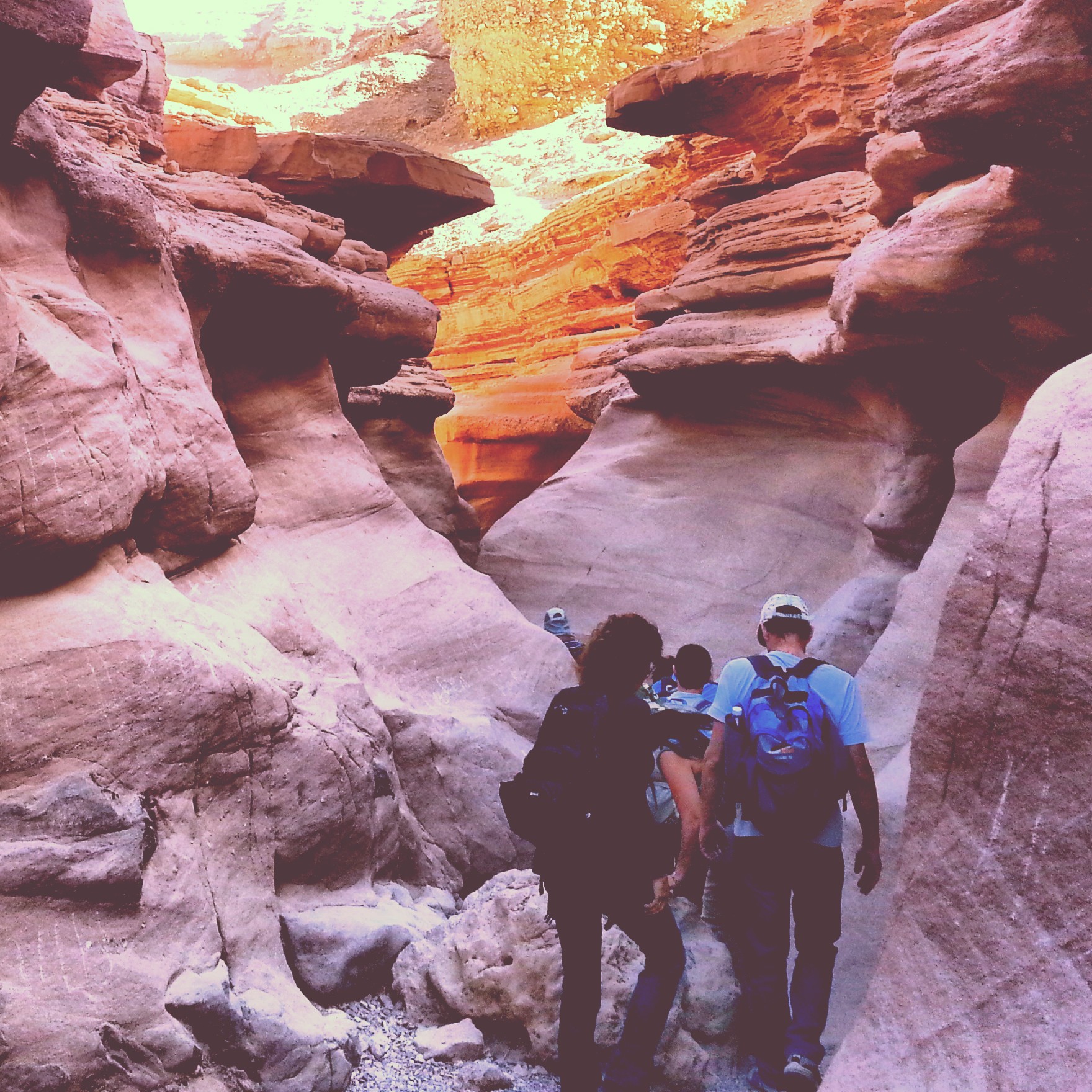
Read about our first day of the Eilat Campus (exploring the Northern Arava and the Ovda Valley) or our second day (exploring the area of Eilat and the Eilat Mountains) or our fourth day (visiting the Timna Valley).

Again, a bright and early start, facilitated by the sumptuous breakfast buffet, and off we went to explore the area of the Southern Arava Valley.

Our first stop, next to the border crossing with Jordan, was at the Eilat Bird Park. As avid readers will recall from our trip to the Hula Valley around a year ago, Israel is a major bird migration station with half a billion birds passing through the country every year in search of warmer climes and the associated increased available foodstuffs. This makes Israel the #2 bird migration centre in the world after Panama.

Our guide shows us some migrating birds in the Eilat Bird Park

For many birds, Eilat is a final stop to build up energy before the long journey over the Sahara desert (or alternatively a first place to restock having crossed it travelling north) and so is a major spot for bird watching. Although we did not have time to wander through the park or sit out with our binoculars, we were fortunate that our guide had saved a few birds from her tagging that morning (they tag the birds for research purposes to try and track their migration patterns) for us to see.

Flamingos in the Avrona Salt Pools near Eilat

We then headed north, admiring the flamingos that have taken up lodging in the nearby salt pools (albeit from a distance), arriving at the Avrona farms.

Crawling through the fugarot / qanat tunnels at the Avrona Farms

This ancient agricultural settlement dates from around the 9th century and utilised a 1.5km long network of underground tunnels to bring water here that would enable farming (the local water has a very high salt content). The technique is known in local Arabic as fugarrot (in Persia, whence it originates, it is known as a qanat system). We crawled through one of the small tunnels – researches believe they were dug by children or even a special team of dwarves!

Doum Palms in the Arava

A short jump north took us to a botanical stop at the Doum Palms. These multi-trunked palm trees are mostly found in the area of the Nile in Africa, the ones located in Israel in the Arava are the most northern instances of this tree in the world and hence are protected.

Hiking through Canyon Shechoret

It was now time to stretch our legs and as we hiked through the Shechoret Canyon. Having made our way through the towering black granite walls of the canyon itself, we ascended to a beautiful viewpoint over the mountains in the area.

View after hiking through Canyon Shechoret

Our guide explained the geological processes that made up the multicoloured peaks and created the rift valley that is the Arava.

Ancient predator trap

On our descent, we passed an ancient animal trap. We learned how it worked together with a little about the local predators. As evidenced on our first day of the campus, there used to be leopards roaming the area of the Negev, although they seem to have now died out (there are rumours that there are still some around though and it is fun to keep them going!).

Safari in the Chai Bar: roaming Oryxes

Wildlife was the subject of our next step as with the sunset approaching we arrived at the Chai Bar. Again, avid readers will recall that we visited the northern Chai Bar during our trip to the Carmel Mountain at the beginning of the course! This is the southern version of this impressive project to research species that used to be in the area, which are now extinct, and to gradually reintroduce them.

Chai Bar: feeding time for the leopards

We enjoyed a safari drive through the park and then visited the predators section; our guide had arranged for us to arrive at feeding time which meant we were able to see some of these impressive animals in action.

Our final stop, with darkness fast approaching, was at a desert kite. These large structures were first identified by RAF pilots in the 20th century; they are found all over the region – Syria, Jordan, Israel etc and were so called because of their resemblance to a toy kite: two walls sloping in to meet at a point.

Remains of a desert kite in the Negev

In fact, they were anything but toys – research shows that the ancient inhabitants of the land used them to catch large herds of animals and then slaughter them. The remains themselves were not particularly impressive (viewed from a height, one gets a better idea of the scale of the things) but it was interesting to get an insight into how our forebears had a good understanding of the local wildlife; and managed to develop frankly ingenious methods to catch them.

Our infamous course coordinator Benny lights the chanukkiah

We returned to Eilat, and it was time for a small celebration! Tonight was the first night of the festival of Chanukah and we concluded the day together with a communal candle lighting, followed, appropriately, by significant doughnut consumption!

Campus Eilat Day Two: Eilat and the Eilat Mountains

Read about our first day of the Eilat Campus (exploring the Northern Arava and the Ovda Valley), our third day (exploring the Southern Arava) or our fourth day (visiting the Timna Valley).

After rising early and having a hearty go at the ample breakfast buffet, it was time to recommence our trip, with today being broadly dedicated to the area of Eilat itself and the Eilat mountains.

We began the day at the area of Umm Rash Rash, the forerunner to the city of Eilat. The area does not have a long history of settlement due to the lack of water resources (the ancient city of Eilat and later Ayla is modern-day Aqaba, across the bay in Jordan), but at some point in the Ottoman period some fishers from Aqaba began to base themselves out here and in the early 20th century an Ottoman army outpost was built to prevent any future British shelling of Aqaba. After WWI, the outpost was taken over by the British.

Um Rash Rash: Operation Ovda Memorial

Here we heard the story of Operation Ovda (Operation ‘Fact’ – the idea being that it would create facts on the ground), the last operation of the Israeli War of Independence. The majority of the Negev desert was not under Israeli control and the Prime Minister, David Ben Gurion, saw it is strategically vital to do so, both in order to secure extra space for the pending waves of immigration, and also to have access to the Red Sea for trade purposes.

However with the war in its final stages and ceasefire negotiations ongoing, the position was tricky. Hence Ben Gurion ordered the Israeli army to take the area of Um Rash Rash with two sets of troops approaching from the east and west, without firing a shot.

Our guide told us the remarkable story of how this was achieved, culminating in two jeeps of soldiers arriving at the deserted Umm Rash Rash post. Here was Israel’s Iwo Jima moment – there happened to be a photographer in the jeep who snapped the historic moment of the raising of their homemade ‘ink’ flag; now there is a sculpture at the site in memory of the occasion.

Hiking the Red Canyon in the Eilat Mountains

We then headed north, along the border with Egypt, deep into the Eilat mountains, for a hike in what is known as the Red Canyon. There is a great deal of red sandstone in the Eilat mountains, formed by erosion of local granite. The hike was just the right level of challenging for me with some lovely views and occasional explanations from our guide about local flora, fauna and geology.

Today was to be the most physically exerting of the campus as we travelled south for a hike through Nachal Shlomo, culminating at the peak of Mt Tzefachot. Our course coordinator had specifically scheduled the Eilat campus at this time of year so that we would be able to enjoy the area in comfortable temperatures (Eilat is the hottest part of Israel) but we were rather unfortunate in that our visit coincided with a ham sin (a heat-wave). Hence we found ourselves making the at times rather steep ascent in temperatures of around 32C!

View from Mt Tzefachot over the Eilat bay

Still, the physical effort was worth it, the view from Mt Tzefachot is quite simply outstanding. Looking north, one sees the many colours of the Eilat mountains; south the view expands over the bay of Eilat. It is also known as the ‘Four Countries Viewpoint’ as in addition to a view over Israel you can see deep into the Sinai Peninsula (Egypt), have a good view of Jordan and can even see the northwestern parts of Saudi Arabia. We sat in silence for a good few minutes at the top, enjoying the rush of the wind and the breathtaking view. No pictures can do this justice!

The Red Sea coral reef from the Eilat underwater observatory

Having finished the hikes, our final stop of the day was at the Eilat Underwater Observatory – the first underwater observatory in the world! There is a beautiful coral reef along the edge of the Red Sea and using the observatory it is possible to descend and look out on multi-coloured coral and the beautiful fish that live together with it. The site also has an aquarium of local fish and various other attractions – I remember enjoying previous visits as a child with my family so there was a bit of nostalgia here. A nice treat to end the day!

Campus Eilat Day One: Northern Arava and Ovda Valley

Read about our second day of the Eilat Campus (exploring the area of Eilat and the Eilat Mountains), our third day (exploring the Southern Arava) or our fourth day (visiting the Timna Valley).

It was time for us to head south, as far south as we could go, on the longest and theoretically final ‘campus’ (i.e. extended overnight trip) of the course – Campus Eilat. Sadly for me I still have Campus Negev to catch up on from when I was sick, but I got into the spirit of the finality of the adventure with my coursemates!

Located on the Red Sea, Eilat is the southernmost point of Israel, around 4 hours non-stop drive from Tel Aviv, which in Israeli terms is a whoppingly huge distance. To justify the long journey, the plan was to spend three nights based in the city and use it as a base to explore the area including the Arava valley, the southern-most parts of the Negev and the Eilat mountains.

We set off in good spirits with today’s focus being the northern part of the Arava valley and then later the Ovda valley. The Arava is on the eastern part of Israel’s southern section, forming the southern part of the border with Jordan.

Ruins of an Israelite fortress at Ein Hatzeva / Ir Ovot

Our first stop was at Ir Ovot, also known as Ein Hatzeva. It is the largest archaeological site in the Arava valley from the biblical period, consisting of three Israelite fortresses. There are also remains from the Roman period including an army camp and a bath house. It was possible to live here as the natural spring made the settlement part of a desert oasis. We explored the ruins and heard theories about the development of the site.

View from the Peace Lookout in the Arava Valley

We then hopped of the main road (route 90, for those who take an interest) to travel south along the lovingly named ‘Peace Route’, named and developed in honour of the peace treaty between Israel and Jordan, it travels along the border with a couple of stops for lookouts over the bandlands of the centre of the Arava valley and the impressive modern agriculture. To the west lie the cliffs and hills of the Negev, to the east the imposing Edom mountains in Jordan.

View from the Jabel Huferia Lookout in the Arava Valley

The viewpoints were lovely, and we learned also about the development of agriculture in this arid landscape. While all the experts said it was impossible to farm here, Israeli pioneers developed drip irrigation techniques and special types of hot houses; now the Arava contributes 60% of Israel’s fruit and vegetable exports.

After a stop for lunch at the famous Yotvata kibbutz (where of course I had some of the celebrated chocolate milk, together with some locally manufactured ice cream – all rather yum) we travelled north west into the Ovda valley. I remember flying into Ovda airport as a child as part of our occasional family holidays to Eilat – it is just one hour drive so is more convenient than flying into Ben Gurion. What I never knew (and it turns out, neither did they) is that there are a wealth of sites to visit in the area.

View over the Arava Valley from Shacharut

We began by driving up to the lonesome settlement of Shacharut. We did not go inside, but stopped off by the road to enjoy the frankly stunning few over the Arava valley and towards the Edom mountains. It was breathtaking. I do so love the desert in Israel, and this was it at its best. Silence and beauty.

Ancient leopard images at the Leopards Temple in the Ovda Valley

We then visited the Leopards Temple, impossible to locate for those who do not know where to look – it is not signposted at all; there is apparently an attempt to almost prevent visitors in order to preserve the site. Dated to the Neolithic / Chalcolithic periods (i.e. around 7000 years ago) this is an amazing site which was used for ritual purposes during this period. It takes its name from the fact that part of the structure contains several images of leopards marked out in stones.

The whole area of the Ovda valley is a treasure trove of archaeological finds from this ancient pre-historic period; it is a relatively fertile area in the desert due to the amount of rainwater that flows into it during flash floods; there is a high concentration of grain threshing floors and living structures here.

Kasui sand dunes in the Ovda Valley

Our final stop was quite a treat: the Kasui sand dunes. I had last been here around 10 years ago during my gap year and had always wondered where it was…now I know! Israel does not really have sand dunes so it is great fun to run up and down (or even roll down!); we stood on the dunes and watched the sun set over the beautiful scenery before us.

We concluded the day at our hotel (yes – hotel!) in Eilat. For our previous trips we stayed in hostels but it seems that the budget was a bit bigger for our Eilat trip. Certainly nice to be a bit spoiled and I did my best with the dinner buffet before retiring early – three more big days lay ahead of us!

Settlement of the Negev in the Modern Period

We continued our exploration of the modern period with today’s trip to learn about the settlement of the Negev, the desert region in the south of Israel. Although the region has had some sparse habitation over history, in the Ottoman period the residents consisted of nomadic Bedouin tribes. The harsh conditions with little water and extreme temperatures did not make settlement overly appealing.

Still, the Ottomans established the city of Beer Sheva anew in 1900 and with the extension of the train to the area came renewed interest in settling it among the Zionists. Particularly David Ben Gurion, the future Prime Minister, saw it as a priority, and believed that the ingenuity of the Zionist movement would overcome any potential barriers.

Museum of Water & Security, Nir-Am

Our first site of the day was the Museum of Water and Security at kibbutz Nir Am, situated a few km away from the border with Gaza. After conducting a geological survey of the area, the Zionists discovered a significant amount of groundwater here. Purchasing old piping from the UK (which had been laid in London to help deal with potential fires during German WWII bombing) they laid out a network to the early Jewish settlements in the area to provide them with water. They also pioneered drip irrigation techniques to help develop agriculture.

Black Arrow Memorial

We left the kibbutz, stopping for a look out over into the Gaza Strip before visiting the Black Arrow memorial. Named after a major paratrooper operation into Egyptian controlled Gaza in the 1950s, this site is dedicated to the famous ‘reprisal’ actions of the same decade. In response to continuing violent incursions into the new Israeli state from Gaza, supported by the Egyptian army, Israel developed a policy of major reprisals in the hope of creating a deterrent to such actions. Each such reprisal action took its toll on the paratroopers involved and there is a memorial dedicated to each operation. From the top of the site it is possible to look over into Gaza, where these actions took place.

RAF Graffiti, Beeri Forest

Continuing south, we visited the Beeri Forest, original site of the Beeri Kibbutz which has now moved very slightly south. The forest contains a couple of old buildings of the kibbutz, together with a sulphur mine and the ruins of a refinery (Israel’s only sulphur depository) which was operational under the British. An RAF squadron were based nearby and it is possible to see some graffiti on the concrete celebrating the end of WWII in 1945.

ANZAC Memorial, Beeri Forest

Also in the park is the ANZAC memorial, dedicated to the Australian and New Zealander forces in the British army who helped liberate the area from the Ottomans in WWI. Based here where you can look over into Gaza where many of their battles took place, we also learned about their key role in the capture of Beer Sheva.

Maon Synagogue Mosaic

Although today was dedicated to more modern history, we made use of our proximity to visit the site of the Maon synagogue. One of only three Byzantine period synagogues in the Negev, it is possible to see the remains of a stunning mosaic with some unusual motifs. It is very similar to a mosaic from a synagogue in Gaza and also to one found in a church at the nearby Ein Shelala – archaeologists believe they may have been made by the same artist.

Homes in Mitzpe Gevulot

After a brief stop for luncheon we visited the site of Mitzpe Gvulot. In 1943, there was still very little settlement in the Negev, and there was a decision to set up three mitzpim (look-outs) in different geological areas to test out agricultural techniques and learn about the best way to manage in the harsh conditions. Gvulot was one of these and we were able to visit many of the original buildings which had been constructed from local materials: bricks of clay and straw. It was quite remarkable to think of the teenagers who moved here from the Balkans in order to be pioneers in the desert; we learned that they had very good relations with their Bedouin neighbours and developed impressive techniques to collect water and irrigate their crops. They even constructed a factory for cutting diamonds although this particular industry did not last very long! It’s possible to visit the site and learn how to make the clay bricks with your own hands, if you’re in the mood for getting a little bit messy.

Hanging Bridge over Nachal Besor

Our final destination was Kibbutz Ruchama, but on the way we had a brief stop at the hanging bridge over Nachal Besor. The bridge leads into the local badlands which provide pleasant view of rolling peaks and crevices. It is possible to hike in the area, but we had to press on.

Security Building in Ruchama

Ruchama was actually the first Jewish settlement in the Negev in the modern period, established in 1911. These early pioneers had a very tough time but were managing to get on top of the conditions until 1917 when the Turks expelled them (they feared they would collaborate with the advancing British forces). The settlement was established twice more in the 20s and 30s before being abandoned in the face of the two major Arab riots in this period. Finally a kibbutz was set up in the 40s and is still around today. It is possible to see some of the original buildings, the impressively deep well and even the remains of an Egyptian plane that the kibbutz members managed to fell in the 1948 war!

Shivta and Nitzana

Another catch-up trip as I travelled south with the English-speaking course from Jerusalem to visit some of the Byzantine period settlements in the Negev: Shivta & Nitzana. I always love going south and watching the landscape gradually become more barren, desolate, wild and beautiful. There is something enchanting about the desert, its peace and calm. Understandably, most tourists in Israel focus their trips around Jerusalem and Tel Aviv, but I really think that more should come down to this wilderness for a completely different Israel experience.

Memorial for the French Commandos

We began our day at a memorial that was en route to our first major stop, dedicated to the French Commandos. In 1948, with the removal of British immigration restrictions, thousands of Jews moved to Israel or came to volunteer in the War of Independence. However, most had no military experience and could not speak Hebrew. A Christian French officer from the French Legion also arrived as a volunteer and offered to put together a unit of French-speakers; he trained them and led them as they played an important role in battles in the south of the country against the Egyptian forces.

We then journeyed south to Shivta, a UNESCO World Heritage site and a very impressive city. It’s a bit of a trek to get there but entry is free and the site is fascinating. It’s one of the most complete cities we have from the Byzantine period in the world and also is the only site in the world where a mosque and church form part of the same building – you can really see the beginnings of Islam taking root, although clearly it was not in a militant fashion.

Byzantine Church at Shivta

Our guide told us about the Nabbateans who would have been the first people to settle this area and about how their culture evolved from being a nomadic one to a settled one; how they adopted the new religions of Christianity and Islam, in the end assimilating into the regular Byzantine population.

We learned how they managed to harness the flash floods of the desert for extensive agricultural activities, and also hosted pilgrims heading south to St Catherine’s Monastery in Sinai, hence the three churches at the site.

We were the only visitors at the site and I really enjoyed the visit. It’s true that it is somewhat off the beaten track but it is worth the journey in my opinion.

Byzantine settlement at Nitzana

From Shivta we continued further south to the border crossing with Egypt at Nitzana, and to the nearby site of Tel Nitzana. From the same period as Shivta, with similar structures, this is much less impressive, largely because the Ottomans used the stones in many of its structures to build a nearby railway station and homes in a village.

Still, it is the site of a very important discovery, that of the Nitzana Papyri. Over 200 papyrus documents were discovered here dating from the 7th century onwards, detailing official matters but also aspects of regular life – marriage, letters, even a request for a tour guide! Also located on the pilgrim route to Sinai, this town would likely have been an important stopping point for those on the journey.

Memorial for the 8th Bridge at Nitzana

As we reached the base of the tel, travelling down a staircase from the Hellenist period in the 2nd century BCE, we paused at a memorial to the 8th brigade and all the soldiers who died here in the battle for Auja in Operation Horev in 1948.

As a bit of treat at the end of the day, we were taken to the Khan Beerotayim near the small settlement of Ezuz. We relaxed by the fire with some tea and coffee, watching the sun set over the beautifully barren landscape, before heading back north with only dreams of the desert to take with us.

Nabatean Cities in the Negev

Today’s trip was dedicated to the Nabateans, an ancient people of the Middle East. We don’t know a huge amount about them as they did not record their own history (or if they did, we have not found it), so their story is told through their encounters with others and archaeological evidence.

They were however clearly a very impressive people who built a massive trading network from modern day Yemen to the port in Gaza, navigating the desert wilderness and building ingenious cisterns that would collect the limited rainwater from the area and prevent it from evaporating so that they could be relied upon by the camel trains. Their capital was in Petra, now in Jordan (and famously featuring in Indiana Jones and the Last Crusade) whence they would set out across the Negev desert to the Gaza port and their spices and later wines would ship across the western world (their wine jugs were even found in the UK).

They originally constructed small waystations in the Negev but eventually these grew into larger settlements. As the Nabatean community in the Negev grew, new towns were constructed in the wilderness. The remains we have are from these larger, later settlements, dating from the Byzantine or late Roman period and have been designated a world heritage site by UNESCO.

View over Mamshit
View over Mamshit

Our trip was based around two of these settlements, Mamshit and Avdat. We began with the former, situated not far from the town of Dimona. Mamshit was in fact a later settlement (from around the 1st Century), in Greek called Mamphis; indeed the epicentre of American rock and roll was named after Mamshit, although having been there a year or so ago I can testify that the surroundings of Tennessee are quite different! As we wondered the ruins our guide taught us about the Nabatean culture, how to identify their architecture and to marvel at the way they managed to live in the desert. We also learned about their assimilation into Roman culture and indeed it seems that Roman soldiers were garrisoned in this city as evidenced by the baths complex and the large stash of coins that were unearthed; probably present to pay the soldiers. We noted an ancient fresco of the story of Cupid and Pysche as further evidence of the absorption into Roman culture; indeed our guide argued that these later Nabateans should be called ‘Descendants of Nabateans’ in order to maintain a distinction between those who maintained the original way of life and those who did not.

Mamshit: 'Nilus' Church
Mamshit: ‘Nilus’ Church

We also marvelled at two ancient churches in the complex, both with beautiful mosaic floors. These Nabatean communities adopted Christianity when it became widespread in the Roman Empire, and the baptisterium which they would have used in their proselytising of the surrounding nomads.

View from Avdat - note the greenery to the left coming from revival of ancient irrigation techniques
View from Avdat – note the greenery to the left coming from revival of ancient irrigation techniques

We headed further south to the jewel in the crown of the Nabatean cities in Israel, Avdat (also known as Ovdat). Named after its founder Oboda, this large city sits atop a hill a little south of Kibbutz Sde Boker. Its inhabitants were early proponents of Ben Gurion’s dream to make the desert bloom; we witnessed the remains of their networks of small channels and aqueducts to make the most of the 80ml of rain a year and to irrigate their terrace farms. In the 50s a small group returned to the area and restored these ancient structures, proving they worked, you can see the small patch of green in the middle of the desert.

At the base of the hill is a visitors centre with a good explanatory film and samples of all the spices and incense that the Nabateans used to transport. Ever wanted to smell myrrh? Now’s your chance!

Avdat: Church of St Theodore

We explored the complex, including a burial cave only for women (possibly priests in a temple to Aphrodite) a former camp site for Roman soldiers, a watch tower and more magnificent early churches. In one, marble inscriptions on the floor marked the final resting places for those who had served the church 1500 years ago. The site is a place of pilgrimage for Christians of today and we witness a group of French Catholics performing a mass inside one of the ancient church structures. It was quite moving.

Once Christianity became widespread in the Roman Empire the Land of Israel grew in importance as the birthplace of the religion – there was a great desire for wine from the Holy Land for religious ceremonies. We saw the remains of an ancient wine press and learned how it would function, also visiting wine cellars at the base of the hill.

Sadly our trip was cut short due to our driver (probably the most important person on the trip) suffering from awful toothache and we missed out on the bathhouse and nearby vast and impressive cistern, but it’s good to save something for the return visit!

Archaeology of the Biblical Negev

After various introductory field trips we are now at a stage where our weekly excursions are broadly supposed to tie in with what we are studying class. Therefore, as we began our lessons on archaeology we spent last week exploring some of the tels (archeological mounds) in the north, and this week we were doing the same but in the south, in the biblical Negev.

However, our first stop was unconnected. En route on the border of the Judean lowlands and the Negev is the Joe Alon Centre for Regional Studies (focused on the Negev region).

Learning about Bedouin culture at the Joe Alon Centre

The main part of the centre (and, in my opinion, the most interesting) is the museum about Bedouin culture. The Bedouin are a nomadic people who in Israel are mostly located in the Galil and desert regions. They are moving away from their traditional life and now the majority live in fixed accommodation; however on travels through the desert it is still possible to see their tents. Although the displays are a little tired and don’t look like they have been touched since the museum opened in the 80s, there is still a lot of interesting information and we were accompanied by a Bedouin guide who went into more details. There was also a short film about the Bedouin in the Negev which was a very good and concise introduction to their lifestyle and the challenges they face in the modern world.

After being led around the museum we were taken into a traditional tent structure where we were served sweet tea and learned about the important culture of hospitality. A most pleasant experience.

From there we quickly looked at the replicas of various cave dwellings in the Negev, from the late stone age to the Bar Kochba revolt, and enjoyed the view over the area from the elevated viewpoint. The tours and videos are available in English (although you probably need to call ahead) and it is a nice stop if one is heading southwards.

Descending into the vast water system at Tel Beer Sheva

We continued south to the region of the biblical Negev. Unlike the Negev of today, this was located only in the area of the valleys of Arad and Beer Sheva, and was a border region between the desert and the rest of the country. Our first destination here was the UNESCO world heritage site of Tel Beer Sheva. Located near modern Beer Sheva, it is considered by some to be the site of the biblical city where Abraham dug his well. The remains on the mound are later, from the post-Exodus period of the Israelite kingdom. They are very impressive (hence the UNESCO recognition). Our guide took us around, explaining the function of different structures and our theories on their uses and purpose. Most incredible was the underground water system, constructed in case of a siege. Huge caverns had been hewn out of the rock and covered with plaster; water was then secretly diverted from the nearby Hebron stream (when it was flowing) into this underground reservoir. We walked out through this water system (for extra fun, we were required to wear hard hats!) and saw the replica of the altar they found at the site; an impressive cube structure with horns on each corner; the original is now in the Israel museum.

Remains of a late Canaanite period 'Arad House' at Tel Arad
Remains of a late Canaanite period ‘Arad House’ at Tel Arad

Our final destination was at Tel Arad, located just outside the city of the same name, where we were honoured to be guided by one of the site’s main excavators. This tel is important as it contains the remains of a vast city from the early Canaanite period, with no further layers above it. This means that archaeologists can use it to really understand what life was like in this period, without the confusion of having other later constructions intermixed. We learned about the typical building construction, now found in other places but still called the ‘Arad House’ as it was here that it was discovered for the first time, and in such large quantities. Our guide also explained to us his theory that the Israelites came into Israel about 1000 years earlier than the current received opinion. Sadly (for him) he seems to be rather alone in this point of view, although he argued his case well. Given that it would mean reorganising the entire chronology of the ancient world, I can see why there might be some resistance.

The original altar in the temple at the Israelite fortress in Tel Arad

We then went up the hill to visit the Israelite period fortress. Although there was no inhabited settlement here since the early Canaanite period, there were fortresses along the border with the unruly desert nomads. The fortress was a large impressive structure, and contains the remains of a temple; evidence that there were other temples outside of the main one in Jerusalem. It seems to have been destroyed at some point, perhaps as part of the concentration of ritual Judaism into the capital city.

We enjoyed the stunning desert sunset over the ancient ruins and then began the long journey home.

Sunset over the ruins of the Israelite fortress at Tel Arad

The Jordan Valley

As we move into the winter months the Jordan Valley was a welcome itinerary as it is well known for having somewhat warmer climes. We left Tel Aviv and ascended up to the Judean Hills into a dense fog, we were enveloped in an ambiance of mystique and perhaps slight foreboding as we crossed over the Green Line and headed to the town of Maale Adumim, and the Martyrius Monastery.

Dining room at Martyrius Monastery

The Monastery dates from the 5th Century (the Byzantine period). Today we would learn about the movement of monks in the Judean desert which is said to have begun with the arrival of Chariton in the year 337. This was an extremely significant movement numbering 20 000 monks spread across 60 monasteries by the middle of the 6th Century. The first monasteries were called laura and consisted of a central cave for the head monk with smaller caves around it. They then evolved (often on the same site) into built structures for communal living known as a coenobium.

This monastery, named for the monk who was at one time Patriarch of Jerusalem, was a large structure housing around 250 monks and also offering lodgings to pilgrims on the Jericho-Jerusalem trail. As we wondered around the ruins our guide explained about how the monks would live in the desert conditions.

We then drove down the hill to the St Euthymius Monastery which has been excavated in the heart of the Maale Adumim industrial zone. St Euthymius inherited Chariton’s mantle as the major monk in the area of the Judean desert having come here from Armenia. He moved around several times but died and was buried in the site upon which the monastery was built. Much of the structure is original although some was restored at the time of the crusaders. In order to prevent his bones being removed by pilgrims St Euthymius left special instructions about a final to be placed above his tomb for them to anoint themselves on. We found the funnel, but sadly his bones were removed at some point in history and are now somewhere among the relics held by churches in Europe.

Inside a vast cistern at St Euthymius Monastery

Particularly impressive was the vast cistern (one of two of this size) used to capture as much rain water as possible to survive the desert heat. We climbed down to the bottom and gazed up at this incredible structure hewn into the chalk rock. An extremely impressive feat of engineering, it even used techniques to protect it from earthquakes (which evidently worked).

To add to the ambiance, our guide played the song “El Borot Hamayim” (to the water cisterns) and handed out sheets with the lyrics. A nice sing along was had.

Inside the church at the Monastery of St Gerassimos

We moved on past Jericho and headed North up route 90 to our final monastery of the day, that of St. Gerassimos. He, like Martyrius, was a disciple of St Euthymius and was credited with pioneering the establishment of monasteries in the area of Jericho. The site was restored over the past 30 years by the Greek Orthodox church and there are now lodgings there for pilgrims together with small mosaic and candle making factories. The church has been refurbished and there are beautiful paintings of various saints and scenes from the bible, together with a brand new home made mosaic floor. The surroundings are very peaceful and shady in the desert sun although sadly they offer no respite from the desert flies.

From this monastery it was a short trip to Qasr el Yahud, an old deserted crusader period monastery on the site of a church dedicated to John the Baptist and built on the orders of Helena (mother of the Roman emperor Constantine, who also ordered the building of various churches in Jerusalem including the Church of the Holy Sepulchre). Just a few meters further and we found ourselves at the bank of the Jordan River at the site where John the Baptist baptized Jesus, effectively founding a new religious movement. There were many groups of pilgrims from around the world quietly praying or singing hymns together; it was a very special ambience.

A pilgrim collects water from the Jordan River at the site of Jesus's Baptism
A pilgrim collects water from the Jordan River at the site of Jesus’s Baptism

The site is also important in Jewish history. It is here that the Israelites entered the Land of Israel for the first time, and where they spent their first Pesach as a free people. It was also the site where the prophet Elijah passed on his leadership position to Elisha before being whisked away to heaven in a chariot of fire. It is a site associated with new beginnings.

Jordan Valley Monument

After a spot of lunch our trip took a more sombre turn as we visited the Jordan Valley monument. Designed by the artist Yigal Turmakin and constructed from old parts of armoured vehicles, tanks and guns, it serves as a memorial to the Israeli soldiers who died in the area, particularly as a result of the period known as the period of pursuits. Once Israel took control of the West Bank in the 1967 Six Day War, Palestinians began to infiltrate from Jordan and carry out attacks. Many soldiers lost their lives to this guerrilla warfare and they are commemorated here.

The site also commands an impressive view over the Jordan valley and into Jordan itself. Our guide pointed out the sites of former strongholds of the Jewish Hasmonean kings in the area together with modern agricultural settlements.

View over the Jordan Valley at the Jordan Valley Monument

From the monument we took the winding road known as the Alon Road (after Yigal Alon, a former army commander and politician) deep into the Samarian hills. The scenery was stunning although it was also a little eerie; much of the area was deserted. Occasionally we would pass small villages or other signs of human life such as olive tree groves and a herd of goats with their shepherd. As we went through our guide pointed out sites mentioned in the bible or of significant excavations. There is a great deal of history in these hills.

Eventually we reached our destination at the Mabua spring in Nachal Perat. The spring is unusual as due to its unpredictable flow. There is an underground cave which fills with rainwater seeping down through the rock. When the water reaches a certain level in the cave, due to a sort of U-bend eroded in the work, the water bursts out into the spring.

Remnants of Hasmonean Aqueducts at Ein Mabua

As dusk fell we walked into the Nachal noting the remnants of what used to be a vast system of aqueducts across the desert, carrying water from the various springs to the Hasmonean fortresses. Now they are in ruins and merely serve as a playground for rock squirrels. We concluded with a little more of group sing song by the spring and with the sound of music in our ears it was time to return home.

Ein Gedi

The first time I went to Ein Gedi, the oasis of the Judean Desert on the shores of the Dead Sea, I was 16 years old, a participant in a month long group trip with my peers. It was August, boiling hot, we were in the middle of the desert, and we were going to do a hike. Things could have looked better. Little did we know that as we walked up the David stream we would soon come upon plunge pools where we would be able to have a much needed cool-off. It is the starkness of its surroundings that makes Ein Gedi so remarkable. A veritable oasis it was, and I will forever associate it with these fond memories.

View over Ein Gedi Reserve and Kibbutz

We began our day at the Ein Gedi Field School, where we saw some ancient artefacts unearthed during excavations in the area. From a viewpoint over the nature reserve we learned about the different inhabitants of the area, dating back to the Chalcolithic period (that’s 5000-6000 years ago), moving through the period of the Israelite kings to the Byzantine era, when the area was famous for its production of the legendary afarsimon oil. This scented oil was so precious in the ancient world that both the Roman historians Pliny and Josephus make reference to how important it was for the Roman rulers to ensure they protected its production during the Jewish revolts. The knowledge of how to make this perfume was lost, but experts believe they have finally identified the plant from which it was sourced. Hopefully we would get to see it later.

We concluded by learning about the modern era; the kibbutz that was founded here by somewhat reluctant pioneers (they arrived in the middle of the summer heat) but they stayed, as they were commanded by Ben-Gurion to do so himself (I don’t think that Israeli prime ministers carry that sort of weight any longer!). We heard about the crops, the difficult balancing act of living with nature in the desert and not using too much of the spring water, and as our guide was a member of the kibbutz he was in the perfect position to talk about some of these tensions. All fascinating background information regaled over a stunning backdrop.

David Waterfall in Ein Gedi Reserve

We moved into the nature reserve, hiking up the David stream to the David waterfall. It is named for David as the book of Samuel refers to him hiding there. Along the way, we paused to learn about the different plants and wildlife in the reserve; their origins and their uses. Our guide taught us about the geological processes which formed the rocks that we were seeing. Sadly, there was no time for a reprise of the plunge pool adventures.

Chalcolithic period temple at Ein Gedi

We turned back and took a steep climb out of the valley to the top of the surrounding cliff. On the way up, we passed signs of ancient civilisation; trenches that acted as an irrigation system for crops built on terraces on the cliff face cisterns and the like. And enjoyed the sweeping views over the Dead Sea valley. Positioned on the top of the cliff was an ancient Chalocolithic temple. Only the bottom stones of the wall remain but you can clearly make out several rooms within the structure. We learned about its probable uses and imagined that in this place, over 5000 years ago, man was coming to pray to his god(s).

We concluded the hike with a more gentle descent past the Ein Gedi spring and a Mamluk period flour mill, arriving at the ruins of an ancient synagogue.

Byzantine Synagogue at Ein Gedi

The synagogue dates from the 3rd Century. The floor contains a beautiful mosaic which has several unusual features compared to similar mosaics from the same period. It also makes a cryptic reference to a curse that would befall any member of the community who reveals its ‘secret’ to an outsider. Many people have posited that this ‘secret’ was with regard the manufacture of the afarsimon perfume. However our guide had a theory that in fact this community, because of its isolation in the desert, was able to hang on to various more mystical beliefs and practices that some Jews had brought with them to Israel from the Babylonian exile, but that the Pharisees (the rabbinic Jews, who had been in a power struggle with the priestly elites) had ruled out from the mainstream. His evidence was compelling; the mosaic makes reference to the three companions of the prophet Daniel (Hananiah, Mishael, and Azariah). In the rabbinic literature (midrash tehillin) it says “we say that the world is based on Abraham, Isaac, Jacob; others say the world is based on Hananiah, Mishael, and Azariah”. Not conclusive, but interesting nonetheless.

Date Palms at Ein Gedi

Around the corner from the synagogue we encountered a hut made entirely of woven palm leaves, situated in the date palm groves. We paused here to learn about the ancient culture of the date palm in the Land of Israel, which was so prevalent that it was also known as the Land of the Date Palm. These trees had a huge variety of uses: food, construction materials, baskets, clothing, cleaning implements. This culture is largely lost but a member of the kibbutz had visited a village in Morocco where it is still alive to learn the techniques and had constructed the hut and its contents. Ben Gurion also saw importance in restoring the culture of the Date Palm and brought to Israel experts from Iraq and Italy to help build new plantations in the early years of the state.

Dead Sea Sinkhole
Dead Sea Sinkhole

From there, we headed across Route 90 to observe some of the sinkholes along the shore of the Dead Sea. It is dangerous to walk there, but as our guide was the leading expert in the country on these sinkholes, he knew how to tread. I’m pleased that I only found out later that he once fell into one and thought he was going to die (read his somewhat harrowing journal here – in Hebrew). Sadly, the Dead Sea is shrinking at a rapid pace. It used to be up to the rude and is now some distance away; the pace was that it was going down 1m a year; now it is 1.5m. This is largely caused by the use of the main tributary, the River Jordan, as a source of water for drinking and agriculture; also by the removal of water by the Dead Sea factories to manufacture minerals. The sinkholes are one of the unfortunate side effects of this; caused by a resulting loss of underground pressure. They are though quite beautiful, in a bleak sort of way. Our guide introduced us to the ‘Dead Sea Diamonds’ which are buried in the clay around the sinkholes; these beautifully formed cubes are actually made of salt. So, in this case, I imagine the diamonds (sadly) are not forever.

Dead Sea Diamond
Dead Sea Diamond


Gilead's Balsam - Source of Afarsimon?
Gilead’s Balsam – Source of Afarsimon?

Our final (and brief) stop as the sun rapidly set was in the botanical gardens in the Ein Gedi kibbutz. There, among other things, they have tried to research and collate the spices mentioned in the biblical book The Song of Songs. Most exciting was the opportunity to see Gilead’s Balsam, the plant from which it is now believed the legendary afarsimon perfume was manufactured. It is still unclear how to make the perfume from the plant, but it really does have a very strong and unique fragrance. We ran our hands over its leaves and the scent accompanied us all the way home to Tel Aviv.